
What Coastal Features will El Niño Modify the Most?
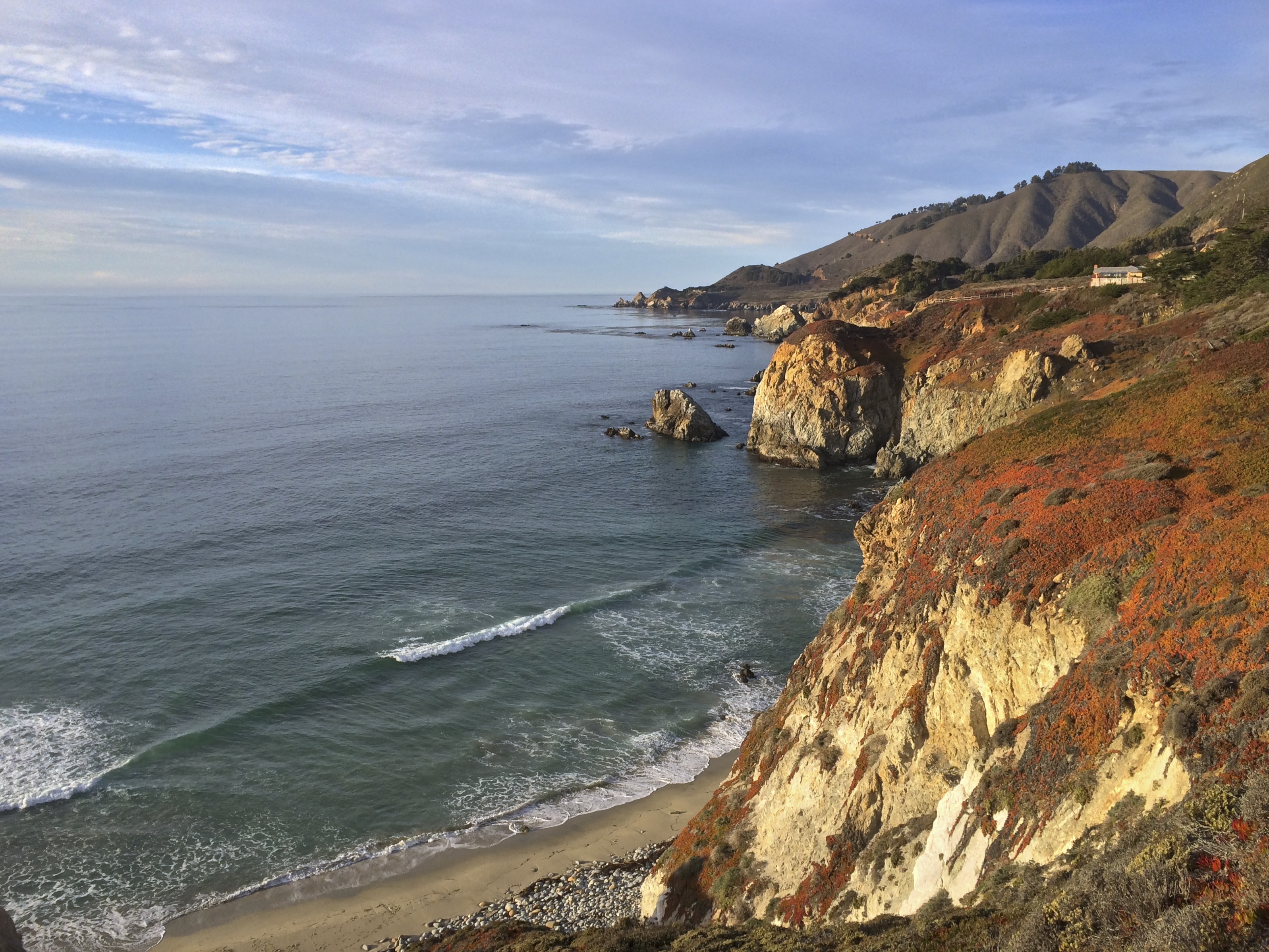
Our coastlines are constantly being modified through wind, wave, earthquake and human influence among others. These activities can either erode or deposit new material to reshape the shoreline. With strong storms brought on by El Niño the erosional process can be significantly accelerated as California witnessed in 1997.
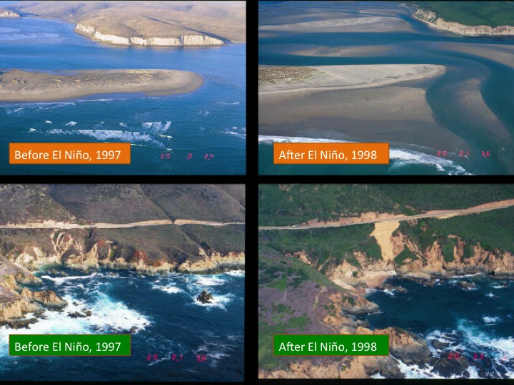
Whenever storms strike our coast, material gets redistributed. Exposed areas like peninsulas or headlands that extend into the sea are prone to higher erosion depending upon the nature of the rock material. The erosion will present itself as landslides and rockslides when the ground becomes saturated with water and steep slopes are not able to retain the additional weight.
Low lying coastal areas are not immune to the thrashing that El Niño storms can deliver. Some areas may experience severe flooding. Runoff from the mountains can inundate these areas or the surge of water from storms may work its way inland to submerge shorelines that are at or near sea level. Only until the storms have died down and the water levels are restored can you actually know the source of the flood water from the deposits that get left behind. In a very general sense, inland runoff will contain mostly mud, silt and clay while ocean flooding will deposit predominantly sandy material. It all depends on what kind of material is available in the ocean or on land.
Coastal Features Created by Natural Processes
Most of the coastal features like sand bars, sand spits, beaches, and barrier islands and many others are created by longshore currents that hug the coast line. This current plays a big role in transporting sand. This is not the only current that runs offshore. The complexity of offshore currents is clearly visible in real-time interactive maps that reveal how storms, upwelling, and larger offshore currents can influence material transport in the ocean.
The video below introduces the various coastal features that are created through erosion and deposition and the role that longshore currents and wind play in molding the coastline. Some of the manmade structures that aim to manage or control coastal erosion are also presented in the short clip.
What happens in the 2015-2016 season remains to be seen, but given the weather forecasts geologists expect it to be an active time along the California coast.


Pingback: The Ocean – Our Last Great Wilderness | my Science Blast
As always, everything is fine! Always watch for new material!
I read about the Internet and decided to do the same online store.
Here he is https://buy-xanax-online-24h.com/en/products/buy-tramadol-250mg.html
Members and Administration myscienceblast.com Say what?
All a Merry Christmas to you health and love!